This structured map skills course uses a simple colourful layout to introduce young pupils to using and drawing maps and plans. Mapstart 1 is a structured introduction to map work for 6-7 year olds. It assumes no previous experience of map skills and establishes a sound foundation for graphic concepts, skills and vocabulary at a very simple level. Mapstart 1 has been designed with the following purposes in mind: • to build children’s spatial awareness through the use of familiar objects, toys, the locality of the school and space photos; • to extend children’s understanding and use of vocabulary associated with spatial location, organisation and movement; • to provide continuity through the book by the use of vertical aerial photos; • to introduce children to the perspective of plans and maps and to the representational characteristics of maps; • to encourage children to observe features and relationships in oblique and vertical photos and maps; • to foster children’s appreciation of the Earth as a globe.
5% OFF First Order Your friend saves on their first order.
5% Commission Earn on referred purchases.
Become an Affiliate Unlock higher earning potential.
Easy Payouts Get paid through supported methods.
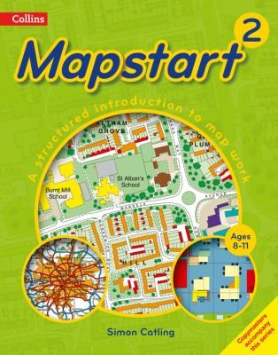
This structured map skills course uses a simple colourful layout to introduce young pupils to using and drawing maps and plans.
Mapstart 1 is a structured introduction to map work for 6-7 year olds. It assumes no previous experience of map skills and establishes a sound foundation for graphic concepts, skills and vocabulary at a very simple level.
Mapstart 1 has been designed with the following purposes in mind:
• to build children’s spatial awareness through the use of familiar objects, toys, the locality of the school and space photos;
• to extend children’s understanding and use of vocabulary associated with spatial location, organisation and movement;
• to provide continuity through the book by the use of vertical aerial photos;
• to introduce children to the perspective of plans and maps and to the representational characteristics of maps;
• to encourage children to observe features and relationships in oblique and vertical photos and maps;
• to foster children’s appreciation of the Earth as a globe.